COVID-19 Hotspots Finding High Risk Populations Using Polaris
COVID-19 is spreading rapidly and impacting an alarming number of people from all walks of life. The demographics of confirmed cases indicate that some groups are much more vulnerable to the virus than others. How can we find the communities which are most at risk? Is the distribution of the most vulnerable groups to COVID-19 geographically even? Using Polaris’s tools and geo-demographic data, we can do a location analysis of the most vulnerable individuals.
We used the following demographic variables to define high-risk populations as follows:
- Senior residents (population of age 65+)
- Presence of chronic health conditions (e.g. diabetes and hypertension)
- Low income (annual income < $30, 000)
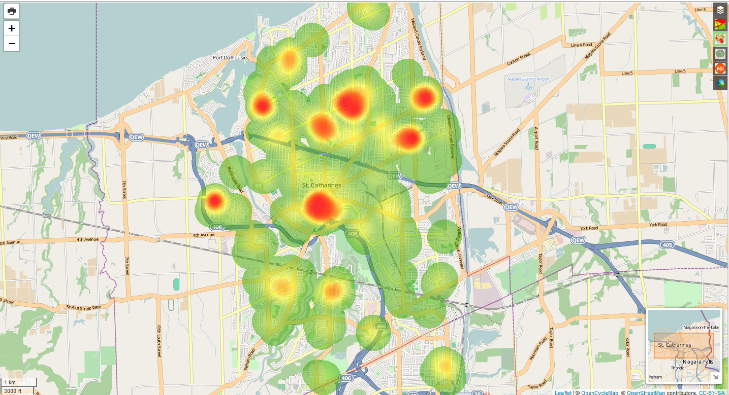
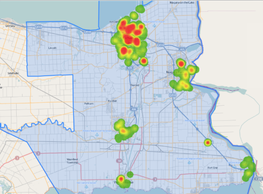
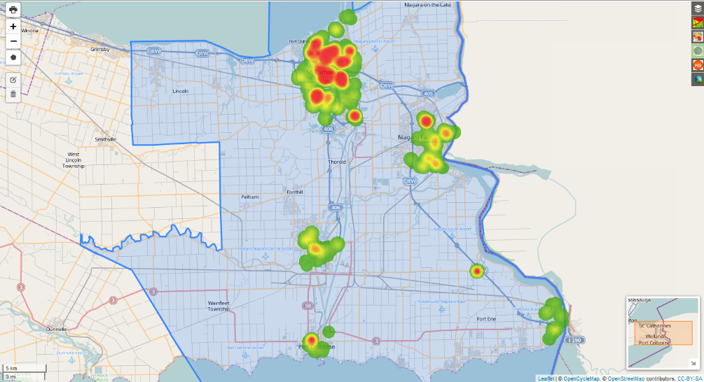
Using this criteria to filter the population within the St. Catharines Census Metropolitan Area (CMA), we created a heat map of the most vulnerable populations. They are concentrated largely in St. Catharines, as well as in the towns of Niagara Falls, Welland, and Port Colborne.
Downtown St. Catharines, parts of Martindale, and parts of the North End in particular, contain high concentrations of vulnerable individuals.