Discover how Canada’s workforce has changed since COVID and why businesses need current employment data to stay competitive. […]
Workforce Data Reveals a Surprising New Reality

Discover how Canada’s workforce has changed since COVID and why businesses need current employment data to stay competitive. […]
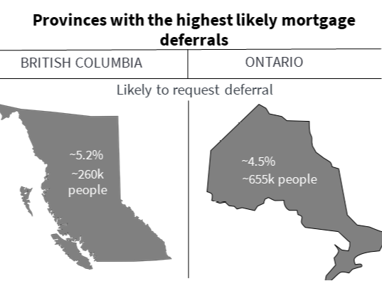
More than 1.5 million Canadians (4% of the Canadian population) will likely ask for a second mortgage deferral in October 2020, and here’s why. Despite partial reopenings, spending on critical sectors is still down. Pre-COVID, 22% of Canadians were employed in these suffering sectors: retail trade (~11% of Canadians), accommodation and food services (~7%), arts (~2%), and real estate (~2%) industries! For RBC in Ontario and BC, that’s $8.5 billion of mortgages at risk! […]

Identifying potential customers can be a challenging and time consuming task. Taking a shot in the dark on who and where your targets results in less success when trying to close a prospect. Prospecting is further complicated by the fact that there are many options you can choose to search for your targets. Options range from search engines (be it LinkedIn or Google), to more high end solutions involving surveys and data analysis but these tend to be time consuming and challenging to execute. […]

Location intelligence refers to the insights gained from layering a variety of useful geographical information systems (GIS) tools (such as POIs, demographics, geofences, heat maps and thematic maps of variables of interest). Using the layered spatial data, as well as the trends and relationships that these tools offer, businesses can make informed decisions on where to offer their services or operate their business. Use cases include site selection, identifying new customers and markets, […]
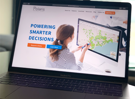
If there was one word to summarize the highlights of this release, it would be “geography”. We added support for a more granular level of geography for Trade Areas and for Thematic Maps. We also added a new report, the “Geography Report”. Of course, in anticipation of a delayed patio season, we also squashed some bugs. We added support for the use of Dissemination Areas (DAs) as Trade Areas. DAs are much smaller than FSAs and a little larger than postal codes, as you can see […]

We invited a nationally recognized partner, RBC, to share their experiences at the Conference on Big Data and Information Analytics at the Fields Institute at the University of Toronto. RBC is a large financial institution with many banking locations across Canada that deeply values the interactions between their customers and employees. RBC’s size presents it with challenges such as ensuring their customers always have a positive […]
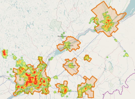
The province of Québec is leading Canada in terms of reopening its economy. What are some financial risks if household incomes in Québec don’t return to normal soon? Are there parallels to be drawn to the rest of Canada? Which areas are most impacted financially and what does this mean for Québec’s real estate market? We can create a simple potential mortgage default index in Polaris by multiplying the following variables: % Household income from employment, Average mortgage […]
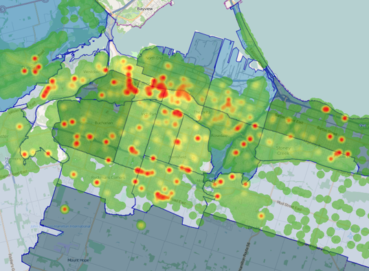
Businesses and organizations looking to analyze their market and gain customer insight need to choose the geographic resolution of their statistical and demographic data. Any GIS analyst can tell you one geographic level of analysis may not be perfect for all questions, and there are many different options to choose from (CMA, CD, DA, FSA, Postal Code level, etc.). Many underestimate the value of postal code […]

The Mapping Centre, Trade Areas, POIs, sharing custom reports, and Data Mining saw a number of improvements this release. In the Mapping Centre, you can now save a picture of your map as a PNG through our new download map feature! When creating trade areas, you can now use latitude and longitude instead of postal code to define the centre or other points! All of your customized reports can now be shared with Polaris users in your group with the click of a button! […]
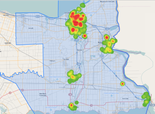
COVID-19 is quickly spreading and impacting an alarming number of people that come from different walks of life. The demographics of confirmed cases indicate that some groups are much more vulnerable to the virus than others. How can we find the communities which are most at risk? Is the distribution of the most vulnerable groups to COVID-19 geographically even? We use Polaris to tackle these questions. […]
 Powered by